Costa Rica spans an area of 50,900 square kilometers, which is relatively small compared to other Latin American countries. Like four other Central American states out of six, Costa Rica has access to both oceans, which is a significant advantage for a country of its size. The country boasts a coastline of 1,228 kilometers, with 1,016 kilometers belonging to the Pacific coast, where diverse geographical features such as bars, spits, lagoons, and more, hold important significance.
The term “flecha,” meaning “arrow” in English, is used in coastal geomorphology to describe an elongated sedimentary extension of the coast, connected at one end and tapering into open water at the other. Synonyms for “flecha” include barra de arena, espiga, barra de espiga, lengua de tierra, banco de arena, punta (commonly used by the locals), flêche, and poulier.
To better define the term, let us refer to specialized literature. While authors generally agree on the most relevant and common characteristics, there might be slight variations. EVANS (1942) defines a barra de espiga as “a crest or embankment of sedimentation connected to the mainland at one end and terminating in open water at the other.”
BRANSON Y TARR (1959) state that “when the littoral current penetrates the end of a bay, deposition extends the coast towards its interior, giving rise to a spit or sandbank.”
THORNBURY (1960) explains that the term “barra” can be used in a generic sense to include various types of submerged and emerged obstructions of sand and gravel formed on the sea bottom by the action of waves and currents.”
HOLMES (1971) writes: “Sediments are carried by deep waters before being deposited on the sea floor and are transported along the coast by waves and littoral currents, where they form sandbanks and beaches and also build bars and spits where the transport power diminishes.”
However, GUILCHER (1957) has compiled the most information and systematized the process and form, which is the focus of the present work.
Historical Background of the Puntarenas Sandbar Historical documents and maps indicate some controversy regarding the existence of the Puntarenas sandbar in the years before the 19th century. Therefore, it is pertinent to gather some background information to determine its relative age. The evidence suggests that its formation was not an excessively rapid process.
For instance, according to Cabalceta, the sandbar on which the city of Puntarenas stands today is of recent formation, as it did not exist in the late 18th century. This assertion is based on the map of the Gulf of Nicoya in William Funner’s book, where such a sandbar is not depicted. Similarly, in a sketch of the Gulf of Nicoya made by the Hydrographic Office of Peru in the late 18th century, the sandy spit is also absent. However, upon close observation, it can be seen that it does appear, albeit incorrectly located, with the name “Punta de Palmas.” The designation of “punta” is an indication that it referred to Puntarenas, and it is very likely that this area was predominantly covered with palm trees, which are common in this part of the country. Approximately halfway along the spit, there is a place known as Cocal.
Historical records indicate that Puntarenas was already mentioned as a place for the docking of sailboats in the late 18th century.
To determine the approximate age of the Puntarenas sandbar, samples of trees considered old were sent to the Biology Laboratory of the National University. The samples were identified as species such as Melicoca bigrega, Ficus nítida, Ziziphus mauritania, and Ficus goldmanii, all of which are fast-growing trees and did not indicate an age beyond fifty or seventy years. This test yielded negative results.
Additionally, church archives were consulted, and documents were found dating back to 1849, including records of baptisms, marriages, and the blessing of the cemetery. These documents indicate the existence of an island, suggesting that littoral currents, the dynamic agents of sedimentation, began to shape the sandy spit based on rocky sedimentation, although it did not immediately form a single body. The appearances of an island could have been due to high tides.
Furthermore, until a few years ago, the sea was connected to the estuary at La Angostura, which may have given the impression of an island.
Even today, during full moon high tides, the low-lying lands next to the estuary on the northern side of the sandbar get flooded. According to tide tables for the port, the highest tides can exceed 3.20 meters.
Based on the evidence, it can be inferred that: a. The presence of a parish in Puntarenas one hundred and twenty-five years ago indicates a sufficient population that warranted its establishment. b. Some ancient cartographic documents mention the existence of a “punta,” which likely corresponds to the forming sandbar. c. It is unlikely that a marine process could have formed a sandbar or spit measuring 7 to 10 kilometers in length in less than a century.
Description of the Area
Puntarenas has become the main port on the Pacific coast of our country, with significant international merchandise traffic.
There are few port cities in the world located on a sandy spit. While some fishing ports can be found in Denmark and both Germanies, especially on the Baltic coast, they do not have the importance and significance that Puntarenas holds for Costa Rica. Arrow-shaped formations like the Puntarenas sandbar are found in some enclosed seas, such as the Baltic and the Black Sea. They can also be found in lakes like the Caspian Sea and in the far north of the Adriatic Sea.
The Puntarenas sandbar is located in the province of the same name, on the eastern shore of the channel leading to the deep Gulf of Nicoya, stretching between the mainland and the Nicoya Peninsula. To the northwest and southeast of the sandbar lies an area of great geomorphological interest.
To the southeast, we first find a straight coastline with a west-northwest to east-southeast orientation, extending to Boca de Barranca beach. This coastal area is rocky with narrow plains dotted with small elevations (such as Cerros Playa Linda, Fila Carballo, Cerro Pavita, etc., with altitudes slightly over one hundred meters) and drained by the Barranca River’s mouth.
Starting from the Barranca River’s mouth and now in a zigzagging north-south direction, two headlands and an inlet succeed each other: in the first one, with undulating topography, there are only Doña Ana beach and then Roca Mesón, Punta Farallón, and Roca Carballo, separated by small beaches. The inlet is Bahía Caldera, lined with beaches. The second headland ends at Punta Corralillos.
To the northwest lies an extensive area of mangroves until Punta Morales, bordered towards the sea by deposits of sand and mud. Behind this area is a wide plain, at least 10 kilometers wide towards the interior, through which the Puntarenas, Aranjuez, Guacimal, and Lagarto estuaries flow. The coastline continues quite regularly, but at Punta Morales and Manzanillo further northwest, small hills with heights reaching 100 meters come closer to the shore, interrupting the mangroves. In front of the port, San Lucas Island and other smaller islands (such as Pan de Azúcar, Guayabos, Muertos, etc.) constitute prominent features of the submerged relief that narrows the communication between the two parts of the gulf. Minor sea depths of less than 20 meters and even less than 10 meters indicate the presence of shallow waters inside the Gulf of Nicoya.
Formation of the Puntarenas Sandbar
The Puntarenas sandbar is located at approximately 9° 58´ North latitude and 84° 50´ West longitude, on the eastern side of the Gulf of Nicoya’s entrance, bordered to the north by the muddy waters of the estuary and to the south by the waters of the Gulf of Nicoya.
After a process that will be explained later, the so-called “estero” (estuary) is, in fact, the “grau” or channel -inlet in English- that receives waters from small rivers that terminate in it perpendicularly.
The explanation for the formation of the sandbar seems relatively simple considering the explanations provided by the relevant literature, applied to the careful observation of maps, aerial and ground photographs.
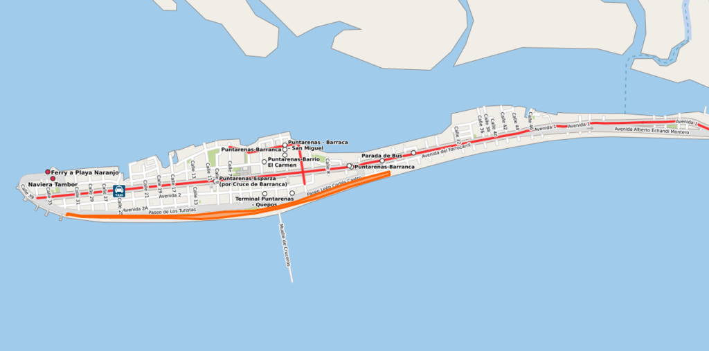
The sandbar elongates from east to west, slightly inclined towards the south, in the same direction as the nearby parallel 10° North latitude, measuring about 10.7 kilometers from its base in San Isidro de Puntarenas (where, according to all circumstances, its formation begins) to Barrio El Carmen at the western end.
Its southern contour is quite regular, which might be due to the leveling works on this side, necessary for the construction of the railway, dating back to 1910. The entire southern edge is also covered by a long beach.
On the estuary side, however, the contour is quite irregular. It starts at a width of 50 meters in La Angostura, progressively increasing until the location of the Chanchera Square. From here, there is a certain uniformity of 80 meters until a new widening of 175 meters at the height of the Sión School. Then follows a decrease to 130 meters at the tuna canning plant. Subsequently, it undergoes a sudden widening again to reach 550 meters between the main dock and the known “muellecito” (Command of Puntarenas). It then narrows to 320 meters at street 24, widens again to 380 meters, and continues quite regularly until its termination.
In this last part, the regularity is due to dredging works carried out to establish the ferry terminal there.
Sandbars begin to form when “sediments are carried by deep waters and transported along the coast by littoral waves and currents, where they form sandbanks and beaches. They also build bars and spits where the transport power of the material decreases.”
If their origin is similar to that of tombolos, there must be a rocky part along the coastline where sedimentation or accumulation starts.
The formation of the Puntarenas sandbar, the most important port on the Pacific coast, should not deviate from this process.
Its formation must have begun on the rocky substrate existing in the eastern part of the city. Those familiar with Puntarenas during the rainy season have noticed that there is always rainwater standing on the land in front of the Monseñor Sanabria Hospital, forming a thin film of almost permanent water. This does not infiltrate because the terrain is rocky and does not allow it, creating a significant mosquito breeding ground.
This is likely the starting point for the formation of the Puntarenas sandbar, but it must have occurred in successive stages.
First, the entire area known today as Chacarita must have formed under the influence of the littoral current until it reached the Chacarita or Naranjo estuary. From that moment, a counterforce appeared at the Naranjo River’s mouth, preventing further union.
The subsequent process has been of considerable importance: on one hand, the estuary contributed to the formation of the sandy spit, giving it a sinuous contour; on the other hand, it created a barrier to the circulation and deposition of sedimentary loads in deep waters brought by the estuary and the following smaller watercourses to the northwest. The shallow depth, one meter or less, of the inner eastern shore of the Gulf of Nicoya, has made conditions suitable for the deposition of material, flooding the area and forming marshes and mangroves up to just beyond Punta Morales.
Careful observation of the maps indicates the presence of submerged bars and sand and mud that edge this part of the coast and might emerge in the coming years.
Successively, the area of mangroves expanded towards the northwest.
The contribution of the Naranjo River, given its length, does not seem sufficient, even when considering the presence of other minor watercourses (Lagarto, Guacimal, Aranjuez), to explain the mangrove area and the sandbar itself.
Apparently, the formation of both must be understood in terms of multiple sources: on one hand, the load coming from the significant fluvial system of the Tempisque River and the aforementioned ones, which discharge their waters into the inner Gulf of Nicoya, must reach the area with the flow of the ebb tide and are deposited by oblique waves (generators of the littoral current). On the other hand, the ocean must provide another set of more energetic waves that come with the high tides, carrying external sediments, especially those deposited by the Grande de Tárcoles River and the Barranca River. Upon entering the gulf, such waves undergo a progressive slowdown experienced by the waves coming from outside, which advance or attempt to advance inland and, at some point, had to deposit and still deposit the materials they carry.
The theoretical scheme described above (theoretical because it needs to be tested) allows stating that only in the place where it formed, at the narrowest part of the channel that drains the waters of the gulf, and with San Lucas Island (or in its vicinity) facing it, could such a characteristic sandbar as Puntarenas have been formed. In this place, the midpoint of the loss of the drag of sediment materials carried by the waters from the interior of the gulf (during low tides) towards the ocean should be found. “It is rare, but not exceptional, to see that, in an intermediate position between the entrance and the most inner part of a bay, a sandbar or pebble bar forms, perpendicular to the bay’s axis, which the French call ‘poulier,’ and in the United States ‘midbay bar.’ Guilcher reinforces this earlier opinion with this.”
The significance of its location and the action of the mentioned forces is also evident in the underwater deposition right after the sandbar itself. This assertion is based on careful observation of aerial photography: the spit extends like a trail under the water’s surface, forming a rounded beach crest with a pronounced southwest inclination. Such a form could be conceived as the initial shape of the current Puntarenas sandbar and the likely conformation if it manages to emerge. It is also possible to notice the thickening of the sandbar as it elongates, a situation related to periods of abundant availability of materials that are deposited in front of the original form. That is also why aerial photographs reveal a considerable widening of the submerged hook.
Original Configuration and Changes to the Present
As explained before, the Puntarenas sandbar was formed by the accumulation of sediments brought by littoral currents and counterforces that did not allow the sandbar to be attached to the coast. All of the above resulted in the original sandbar having a very irregular spear-shaped form, forming a narrow part (La Angostura) at the junction of the opposing forces. Thus, in 1860, it had the following shape.
Twenty-five years later, the Puntarenas sandbar had the following form, which is normal in this type of formation, meaning its tendency to curve at the end and attempt to close to form a lagoon. This is known as “poulier.”
After taking the above form, a strong erosion occurred in the curvature until the construction of breakwaters interrupted this process, and Puntarenas acquired the shape it is known for today, as described in the attached document.
CONCLUSIONS
The elaboration of this work has led to the following conclusions:
- The formation of the Puntarenas sandbar dates back to more than two hundred years.
- The Puntarenas sandbar has changed its configuration over the years, following a normal process for this type of sandbar.
- Puntarenas tends to join the mangrove; this can be observed in the field when low tides reveal the huge accumulation that has formed in the estuary. In fact, dredging is done occasionally.
- The Puntarenas sandbar has not finished forming; accumulation continues to occur. Currently, it is approximately three meters above sea level.
- In the event of a tsunami, it is very likely to flood the city but cause little damage as the tsunami’s force would be reduced due to the distance it has to travel from the Gulf of Nicoya’s entrance and its weakening when colliding with the islands.
- The construction of port facilities in Caldera has caused a reduction in the ocean’s sedimentary contribution (which can be observed first in Caldera and then in Puntarenas), but it will not affect its existence itself.
BIBLIOGRAPHY
- Branson, E.B. and Tarr W.A. “Elements of Geology.” Editorial Aguilar, Madrid, Spain. 1959.
- Cabalceta, Gilberth. “Monografía de la ciudad de Puntarenas.” Licentiate Thesis. Heredia, Costa Rica. 1974.
- Derruau, Max. “Geomorphology.” Editorial Ariel, Barcelona, Spain. 1966.
- Guilcher, André. “Coastal and Submarine Morphology.” Editorial Omega, Barcelona, Spain. 1957.
- Holmes, Arthur. “Physical Geology.” Ediciones Omega S.A. Barcelona, Spain. 1971.
- Revista de Geografía de América Central (separate). School of Geography. Faculty of Earth and Marine Sciences. National University. Heredia, Costa Rica. 1975.
- Thornbury, William D. “Principles of Geomorphology.” Editorial Kapelusz, Buenos Aires, Argentina. 1960.
Author: Chen-Apuy Cabalceta, Nicolás